Argo Data access
The Euro-Argo fleet monitoring tool allows any user to visualise Argo profiling float metadata, ocean measurements, trajectories and technical parameters. It gives access to a fleet dashboard and also provide detailed information on a specific Argo float webpage (by WMO number).

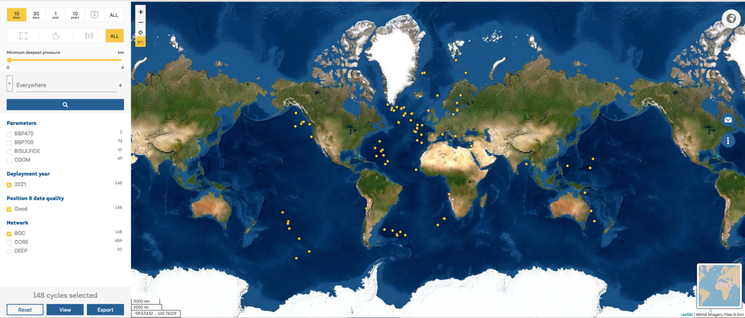
The Euro-Argo data selection tool is specifically designed for users to select, visualise and download Argo scientific data (profiles files) in different formats.
Note: this website is an update of the previous tool available from the Argo Data Management website. Please send us any feedback you may have. The developments have been funded by the H2020 Euro-Argo RISE and ENVRI-FAIR projects.
The APIs used by these two web portals are open and publicly available to interested users at the following endpoints OpenAPI (swagger):
- https://fleetmonitoring.euro-argo.eu/swagger-ui.html
- https://dataselection.euro-argo.eu/swagger-ui.html
They allow any user to retrieve, query and browse Argo data and metadata records.
Please contact us should you require more information or assistance using these APIs. We will also be glad to hear your feedback if they are used for different projects or purposes.
We can already report some happy users of the Euro-Argo APIs:
- ODATIS (http://bluecloud.odatis-ocean.fr)
- Blue-Cloud (https://www.blue-cloud.org/data-infrastructures/euro-argo)
These developments have been funded by the H2020 Euro-Argo RISE and ENVRI-FAIR projects.
The Argopy software is a python library that aims to ease Argo data access, manipulation and visualisation for standard users as well as Argo experts and operators (Maze and Balem, 2020). With “Argopy” you can download online or retrieve offline from a GDAC ftp copy a collection of Argo measurements (T/S, and soon all BGC variables) based on a space/time domain or Argo floats numbers. “Argopy” is free, open source, compatible with all platforms and welcomes any kind of contributions.